

 illustration from DKI Services
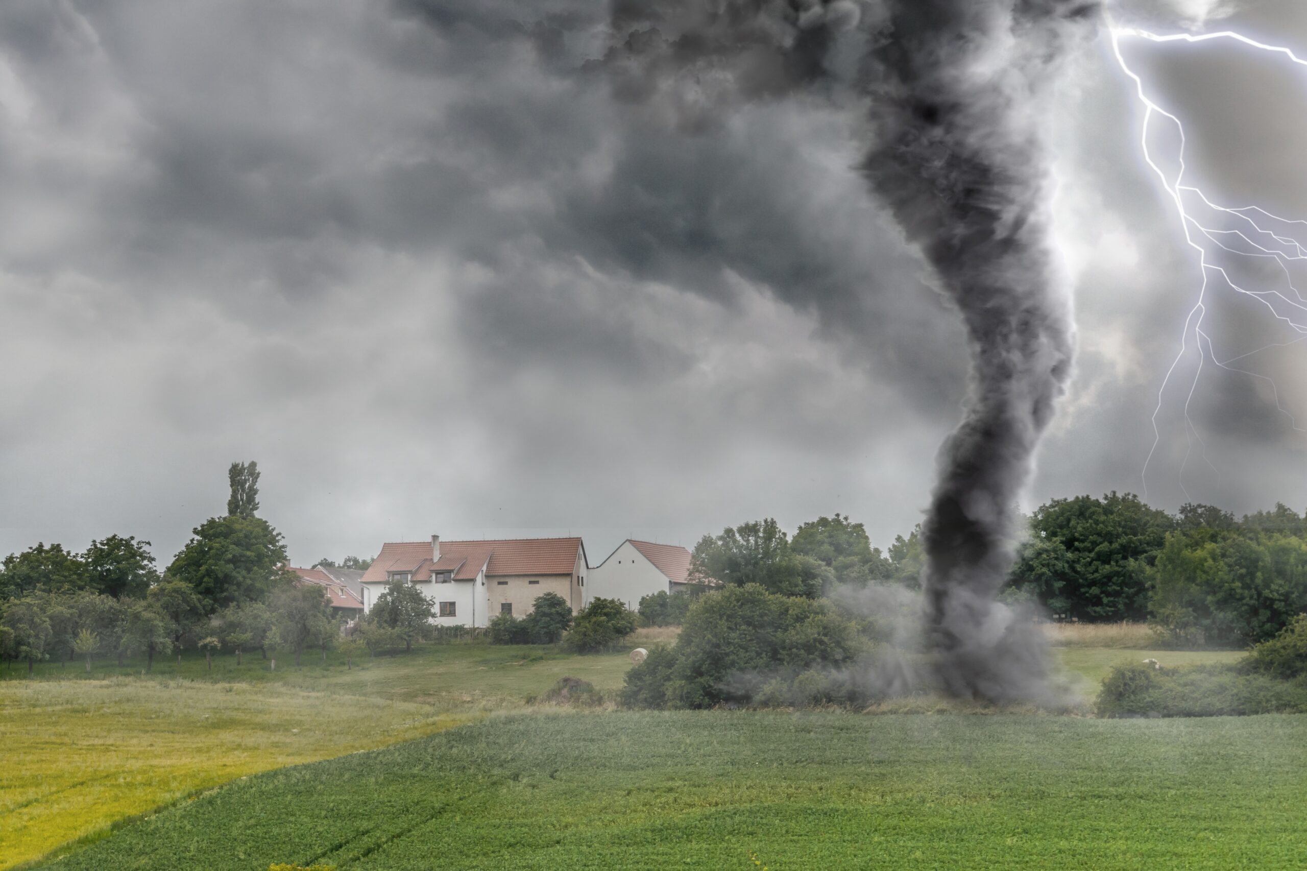
Beneath the Swirl: Understanding Tropical Storm Chantal
Tropical cyclones, known variously as hurricanes, typhoons, or tropical storms, stand among nature's most formidable and captivating forces. Powered by the latent heat released from warm ocean waters, these colossal systems unleash destructive winds, torrential rains, and significant disruption. While major hurricanes often dominate headlines, tropical storms, characterized by sustained winds ranging from 39 to 73 mph, can inflict substantial damage and upheaval.
Tropical Storm Chantal serves as a compelling case study, illustrating both the intricate meteorological processes at play and the tangible impact such systems have on human lives and infrastructure. Though not a Category 5 giant, Chantal's journey across the Atlantic highlighted the complex dance of atmospheric forces and left its mark on affected regions. This article explores the science driving these swirling vortices and delves into the specific path and consequences of Tropical Storm Chantal, examining how these systems form, evolve, and interact with the world below.
Defining the Swirl: What is a Tropical Storm?
To fully appreciate Tropical Storm Chantal, we must first grasp the fundamentals of tropical cyclones. A tropical cyclone is a rapidly rotating storm system featuring a low-pressure center, a closed low-level circulation, powerful winds, and spiral bands of thunderstorms producing heavy rain. They draw immense energy from the condensation of moist air, releasing vast amounts of heat that warm the storm's core, causing air to rise and further lowering surface pressure, thus strengthening the circulation.
Tropical cyclones are categorized based on their maximum sustained wind speeds:
- Tropical Depression: Winds up to 38 mph (61 km/h).
- Tropical Storm: Winds from 39 to 73 mph (63 to 117 km/h). This is the stage where the storm receives a name.
- Hurricane (or Typhoon/Cyclone): Winds of 74 mph (119 km/h) or higher, classified further using the Saffir-Simpson Hurricane Wind Scale (Category 1-5).
Tropical storms represent a critical intermediate phase – more organized than depressions, posing a significant threat from heavy rain and moderate winds, and holding the potential to intensify into hurricanes.
Chantal's Genesis: From Ripple to Rotation
Every tropical cyclone begins humbly, often as a tropical disturbance – a disorganized cluster of thunderstorms. For it to escalate to a tropical depression and then a tropical storm, specific environmental conditions must align:
- Warm Ocean Waters: Temperatures of at least 26.5°C (80°F) down to 50 meters (160 ft) are needed to provide heat and moisture.
- Atmospheric Instability: Air must cool rapidly with height, fostering convection and thunderstorm development.
- High Humidity: Abundant moisture, particularly in the lower to mid-atmosphere.
- Low Vertical Wind Shear: Minimal change in wind speed or direction with altitude prevents the storm's structure from being disrupted.
- Pre-existing Disturbance: A trigger like a tropical wave is typically required to initiate convection.
- Coriolis Effect: Sufficient distance from the equator (usually > 5 degrees latitude) is needed for Earth's rotation to induce circulation.
Tropical Storm Chantal typically originated from a tropical wave migrating westward off the African coast. As this wave traversed the warm tropical Atlantic, it encountered these favorable conditions. Thunderstorms consolidated, a low-pressure center solidified, and circulation intensified, leading to its designation first as a depression and then, upon reaching tropical storm winds, named Chantal.
Tracking Chantal's Journey: An Atlantic Passage
Understanding Tropical Storm Chantal's path is essential to assessing its potential impact. Tropical cyclones are guided by large-scale atmospheric currents. Atlantic systems often initially move westward or northwestward, pushed by trade winds and the Bermuda High pressure system. The exact location and strength of the Bermuda High critically influence whether a storm continues westward towards the Caribbean/Gulf or curves northward.
Chantal's track, like many such systems, was dictated by these steering currents. Its relatively quick passage across the Atlantic, while potentially limiting maximum intensity, meant it could reach land areas faster, shortening preparation time. Its typical path brought it through or near the Lesser Antilles and potentially other northeastern Caribbean islands, before potentially heading towards the Greater Antilles or out to sea, depending on the specific event and prevailing patterns.
Meteorologists monitor these systems using advanced tools: satellites provide continuous imagery; radar tracks rain and wind near land; reconnaissance aircraft like the 'Hurricane Hunters' gather crucial in-situ data; and surface observations from buoys and ships fill in details. This data feeds into sophisticated computer models that forecast the storm's future track and intensity, although intensity prediction remains a key challenge.
Inside the Storm: Chantal's Structure
Even without a distinct eye wall characteristic of hurricanes, a tropical storm like Chantal possesses a powerful structure. At the core is the low-pressure center. Spiraling inward are bands of thunderstorms – the spiral rainbands – where the strongest winds and heaviest rains occur.
The energy release through condensation is most vigorous within these rainbands near the center. Warm, moist air rises, cools, and releases latent heat as water vapor condenses into rain, fueling the storm. Air rising in the core eventually flows outward at the storm's top (outflow), which is crucial for ventilation and organization. Cooler, drier air sinks outside the core, completing the circulation.
While hurricanes feature a clear, calm eye, a tropical storm's center may be ragged or obscured. The strongest winds are typically in a band around the center, similar to a hurricane's eye wall but less defined and less intense. Wind and rain distribution is often asymmetric; the right-front quadrant (relative to the storm's movement) often sees the strongest winds due to the storm's forward speed augmenting rotational winds.
The Engine Room: Energy and Dynamics
The power inherent in a tropical storm like Chantal is immense, releasing energy equivalent to multiple atomic bombs every second. This energy originates from the ocean. Evaporation from warm waters infuses the atmosphere with vast amounts of water vapor. As this moist air rises within the storm, condensation releases latent heat, warming the air, increasing buoyancy, and accelerating the upward motion. This pulls in more moist air from the surface, creating a positive feedback loop that fuels intensification.
The storm's rotation is initiated and sustained by the Coriolis effect, which deflects air moving towards the low-pressure center (to the right in the Northern Hemisphere). As air converges towards the core, its rotation speed increases, akin to a figure skater pulling in their arms – a principle tied to the conservation of angular momentum.
Understanding these dynamics is vital for forecasting. Factors that can weaken a tropical storm include:
- Moving over cooler water: Deprives the storm of its primary energy source.
- Moving over land: Cuts off moisture and increases friction.
- High vertical wind shear: Tears apart the storm's organized structure.
- Interaction with dry or stable air: Suppresses thunderstorm activity.
Chantal's intensity likely fluctuated during its lifespan, influenced by these factors. Predicting these changes accurately remains one of tropical meteorology's greatest challenges.
Chantal's Impact: More Than Just Wind
Even as a tropical storm, Chantal posed significant threats. The primary impacts typically include:
- Heavy Rainfall & Flooding: Tropical storms are prolific rainmakers. Slow movement or interaction with terrain can cause devastating inland flooding and landslides, often far from the coast. Chantal likely brought heavy rain to affected islands, leading to flash floods and landslides, particularly in hilly or mountainous areas, damaging homes, infrastructure, and agriculture, and posing a severe threat to life.
- Moderate to Strong Winds: Winds of 40-70 mph, while not hurricane-force, are strong enough to cause damage, including downing trees and power lines (leading to outages) and damaging roofs and weaker structures. Wind-blown debris becomes hazardous projectiles.
- Coastal Flooding & Storm Surge: Though generally less severe than with hurricanes, storm surge can still occur, especially in vulnerable coastal areas. Combined with high tides and waves, even a modest surge can cause inundation, erosion, and property damage. Chantal's coastal impact depended on its exact track, proximity to the coast, and timing relative to tidal cycles.
- Rip Currents: Even storms far offshore can generate dangerous rip currents, posing a hazard to swimmers along coastlines.
- Disruption: Beyond direct damage, Chantal's passage would have disrupted transportation, communications, power, and essential services, impacting daily life and economic activity.
The specific impacts of Tropical Storm Chantal varied by location, depending on proximity to the storm center and local vulnerability. Reports from affected areas typically detail power cuts, flooded roads, structural damage, and agricultural losses. Storm speed also matters; faster storms might cause more wind damage but less localized extreme rain than slower ones. Analyzing Chantal's specific characteristics provides valuable lessons.
Preparedness and Response: Standing Ready
Effective response to a tropical storm like Chantal hinges on robust preparedness:
- Stay Informed: Follow advisories from meteorological and disaster management agencies.
- Plan Evacuations: Know routes and shelters, especially for vulnerable areas.
- Secure Property: Protect windows, doors, and outdoor items.
- Prepare Kits: Assemble emergency supplies (food, water, medicine, lights, etc.).
- Communicate: Establish family communication plans.
Government agencies and aid organizations are crucial for warnings, evacuations, sheltering, and search/rescue. Post-storm, focus shifts to damage assessment, restoring services, clearing debris, and providing aid. The response to Chantal tested the preparedness and resilience of communities in its path.
Tropical Storms in a Changing Climate
The link between climate change and tropical cyclones is an active research area. While the total number globally may not be increasing, climate change is influencing their characteristics:
- Increased Intensity: Warmer oceans provide more energy, potentially increasing the likelihood of storms reaching major hurricane strength.
- Heavier Rainfall: A warmer atmosphere holds more moisture, leading to higher rainfall rates and increased flood risk.
- Sea Level Rise: Exacerbates storm surge impacts, pushing water further inland.
- Potential Track Changes: Research suggests possible shifts in storm tracks, though this remains an area of study.
While attributing Chantal solely to climate change is complex, the environment in which such storms form is undoubtedly changing. Understanding these trends is crucial for long-term planning and building resilience in vulnerable regions.
Learning from Chantal's Path
Every tropical storm, including Chantal, offers valuable lessons. Meteorologists gain insights for refining models, emergency managers evaluate preparedness, and communities reinforce the importance of heeding warnings. Chantal's passage likely highlighted the need for resilient infrastructure, effective communication, and local preparedness.
Its speed was a potentially significant factor – a fast storm can surprise but may cause less prolonged rain; a slow one allows more preparation but can dump catastrophic amounts of rain. Analyzing Chantal's specific speed and rainfall distribution aids planning for future events.
Conclusion: Coexisting with Coastal Hazards
Tropical Storm Chantal serves as a powerful reminder of the dynamic forces shaping our planet. It illustrates the fundamental science behind tropical cyclone formation and intensity, driven by thermodynamics and fluid dynamics. Its impact underscores the vulnerability of coastal and island communities to these natural hazards and highlights the indispensable role of accurate forecasting, clear communication, and proactive preparedness.
As the climate evolves, understanding and preparing for events like Tropical Storm Chantal becomes increasingly vital. Investing in resilient infrastructure, early warning systems, and public education are crucial steps towards mitigating future impacts. By studying storms like Chantal, we enhance our collective knowledge, enabling us to live more safely and sustainably in regions exposed to the powerful swirl beneath the eye.
Stay Informed, Stay Prepared
The most effective defense against tropical storms and hurricanes is knowledge and preparation. If you reside in a tropical cyclone-prone area, take time to understand your risks, develop a family emergency plan, assemble a disaster kit, and stay vigilant during hurricane season. Your preparedness is your most significant asset in protecting yourself, your loved ones, and your property.
Published on July 7, 2025
reference: Various Article on internet
Share to:
![]()
![]()
![]()
![]()
![]()

Gema
Wordsmith and content writer passionate about creating high-quality content that informs, entertains, and inspires. Let me bring your brand's story to life.
All stories by : GemaRelated Posts
-
February 9, 2025
Surviving 3 Days in Komodo National Park with Komo...
-
February 15, 2025
Ace Your Exams: Proven Strategies for Success in S...
-
March 29, 2025
Conquering the Leap: From Algebra to AP Success
0 Comments